This page conforms to the XHTML standard and uses style sheets. If your browser doesn't support these, you may not see the page as designed, but all the text is still accessible to you.

SCHENECTADY DIGITAL HISTORY ARCHIVE

Bringing the heritage of Schenectady County, New York to the world since 1996

You are here: Home » Resources » MVGW Home » Maps » Little Falls Gorge

History of the Mohawk Valley: Gateway to the West 1614-1925
The Little Falls Gorge

[This information is from Vol. I, p. 47 of History of the Mohawk Valley: Gateway to the West 1614-1925, edited by Nelson Greene (Chicago: The S. J. Clarke Publishing Company, 1925). It is in the Reference collection of the Schenectady County Public Library at R 974.7 G81h. This online edition includes lists of portraits, maps and illustrations. As noted by Paul Keesler in his article, "The Much Maligned Mr. Greene," some information in this book has been superseded by later research or was provided incorrectly by local sources.]

Contents | Biographies | Illustrations | Maps | Portraits

Go back to: Chapter 1

Little Falls Gorge.

[View 4x enlarged version (158K)]

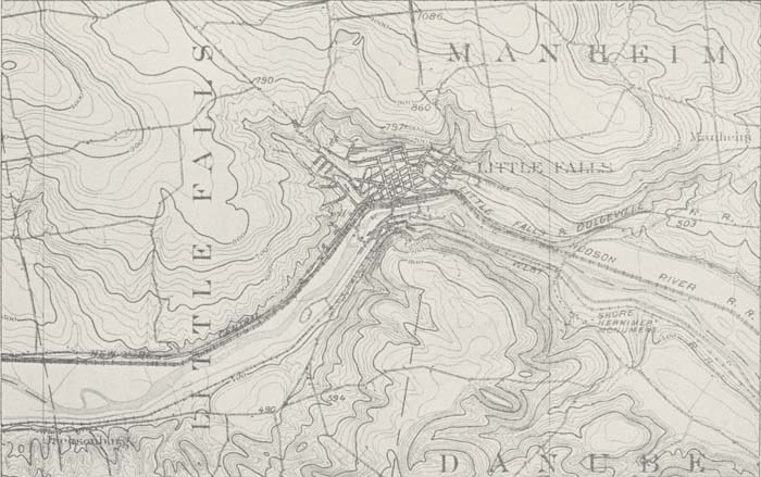
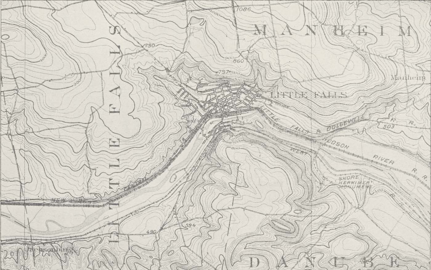
Topographic map showing the deep, narrow gorge of the Mohawk River at Little Falls. The walls of the gorge rise fully 50 feet above the river which is less than 400 feet above sea level. The gorge is postglacial in origin and before the great ice age it was replaced by an important divide with one stream (Mohawk River) flowing eastward and another stream flowing westward. Part of Little Falls (U. S. G. S.) quadrangle. Scale, about 1 mile to the inch.]

Go to top of page | back to: Chapter 1

You are here: Home » Resources » MVGW Home » Maps » Little Falls Gorge

http://www.schenectadyhistory.org/resources/mvgw/maps/little_falls_gorge_map.html updated June 10, 2018

Copyright 2018 Schenectady Digital History Archive — a service of the Schenectady County Public Library

Statcounter