This page conforms to the XHTML standard and uses style sheets. If your browser doesn't support these, you may not see the page as designed, but all the text is still accessible to you.

SCHENECTADY DIGITAL HISTORY ARCHIVE

Bringing the heritage of Schenectady County, New York to the world since 1996

You are here: Home » Resources » MVGW Home » Maps » Lindsay and Livingston Patent

History of the Mohawk Valley: Gateway to the West 1614-1925
Map of the Lindsay and Livingston Patent in the Town of Danube

[This information is from Vol. I, p. 515 of History of the Mohawk Valley: Gateway to the West 1614-1925, edited by Nelson Greene (Chicago: The S. J. Clarke Publishing Company, 1925). It is in the Reference collection of the Schenectady County Public Library at R 974.7 G81h. This online edition includes lists of portraits, maps and illustrations. As noted by Paul Keesler in his article, "The Much Maligned Mr. Greene," some information in this book has been superseded by later research or was provided incorrectly by local sources.]

Contents | Biographies | Illustrations | Maps | Portraits

Go back to: Chapter 37

Map of Map of the Lindsay and Livingston Patent in the Town of Danube

[View 9x enlarged version (283K)]

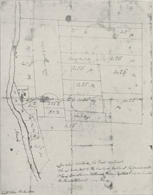
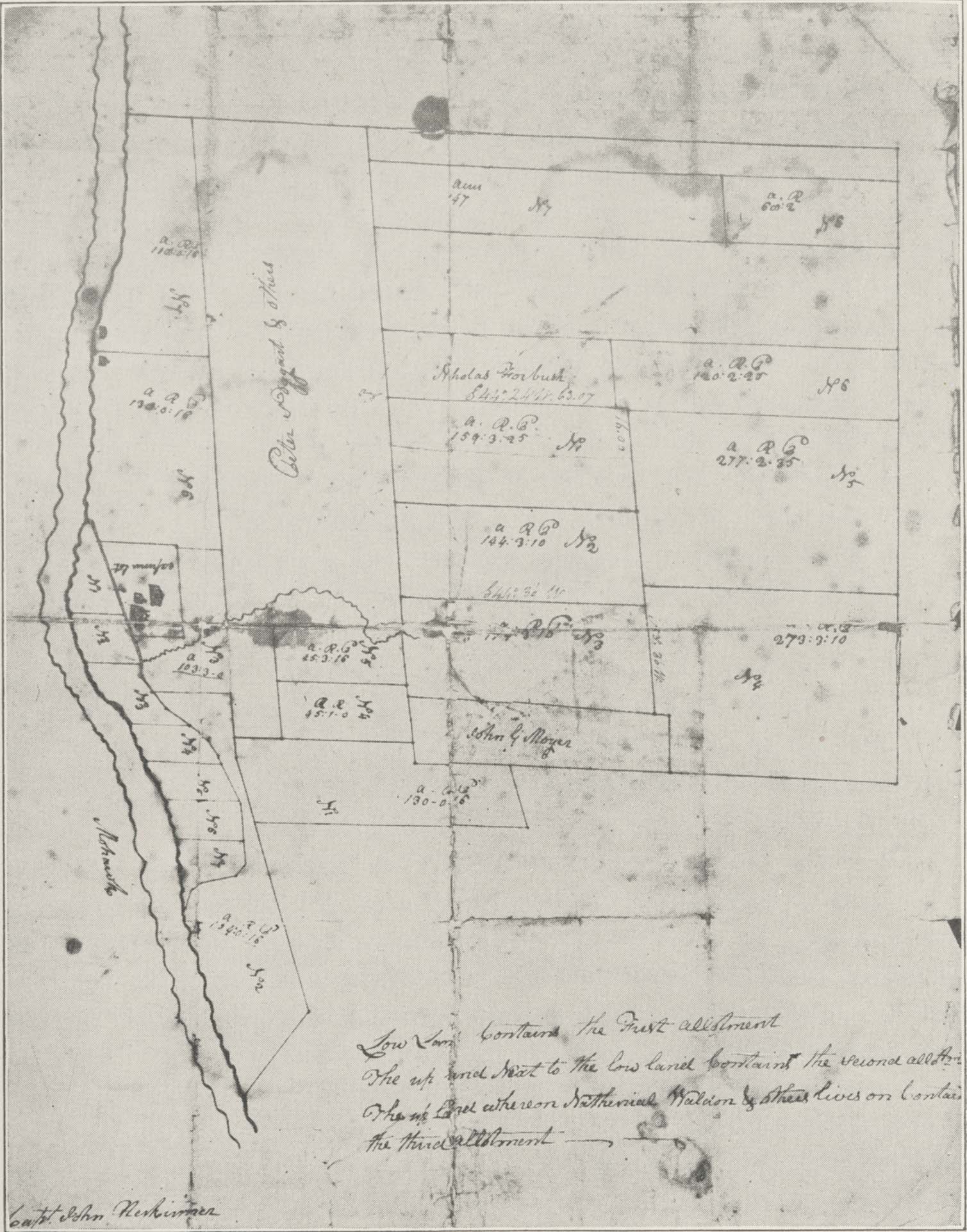
Map of the Lindsay and Livingston Patent in the Town of Danube.

Three thousand acres granted to John Lindsay and Phillip Livingston. Lindsay was the founder of Cherry Valley; granted August 24, 1736. (From the collection of Mr. S. Ludlow Frey, Palatine Bridge.)

Note in lower left corner: [illegible, could be Capt.] John Herkimer

Note at lower right:

Go to top of page | back to: Chapter 37

You are here: Home » Resources » MVGW Home » Maps » Lindsay and Livingston Patent

http://www.schenectadyhistory.org/resources/mvgw/maps/lindsay_patent_map.html updated June 10, 2018

Copyright 2018 Schenectady Digital History Archive — a service of the Schenectady County Public Library

Statcounter