This page conforms to the XHTML standard and uses style sheets. If your browser doesn't support these, you may not see the page as designed, but all the text is still accessible to you.
Map 4: 1750, Plan of Schenectady
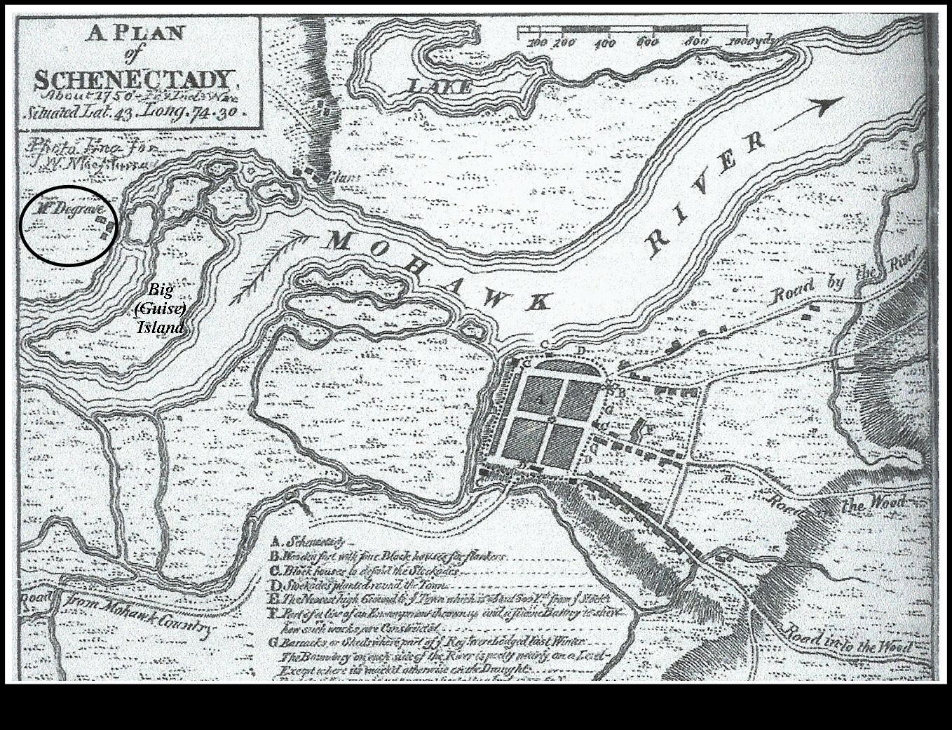
[View 4x enlarged]
This drawing was made about 1750 and shows the layout of what was then the Town of Schenectady and the surrounding lands. Big (Guise) Island in the Mohawk River is marked and the buildings of "Mr. Degrave" (i.e., DeGraff) on the Scotia side are circled.
http://www.schenectadyhistory.org/buildings/scotia/flint_house/jones/map04.html updated March 30, 2015
Copyright 2015 Schenectady Digital History Archive — a service of the Schenectady County Public Library