This page conforms to the XHTML standard and uses style sheets. If your browser doesn't support these, you may not see the page as designed, but all the text is still accessible to you.

SCHENECTADY DIGITAL HISTORY ARCHIVE

Bringing the heritage of Schenectady County, New York to the world since 1996

You are here: Home » Resources » MVGW Home » Illustrations » City of Little Falls

History of the Mohawk Valley: Gateway to the West 1614-1925
City of Little Falls

[This information is from Vol. II, p. 1761 of History of the Mohawk Valley: Gateway to the West 1614-1925, edited by Nelson Greene (Chicago: The S. J. Clarke Publishing Company, 1925). It is in the Reference collection of the Schenectady County Public Library at R 974.7 G81h. This online edition includes lists of portraits, maps and illustrations. As noted by Paul Keesler in his article, "The Much Maligned Mr. Greene," some information in this book has been superseded by later research or was provided incorrectly by local sources.]

Contents | Biographies | Illustrations | Maps | Portraits

Go back to: Chapter 125

City of Little Falls

[View 9x enlarged version (688K)]

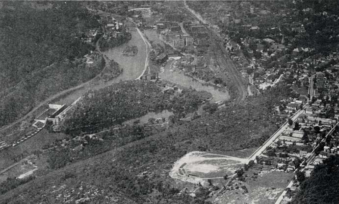
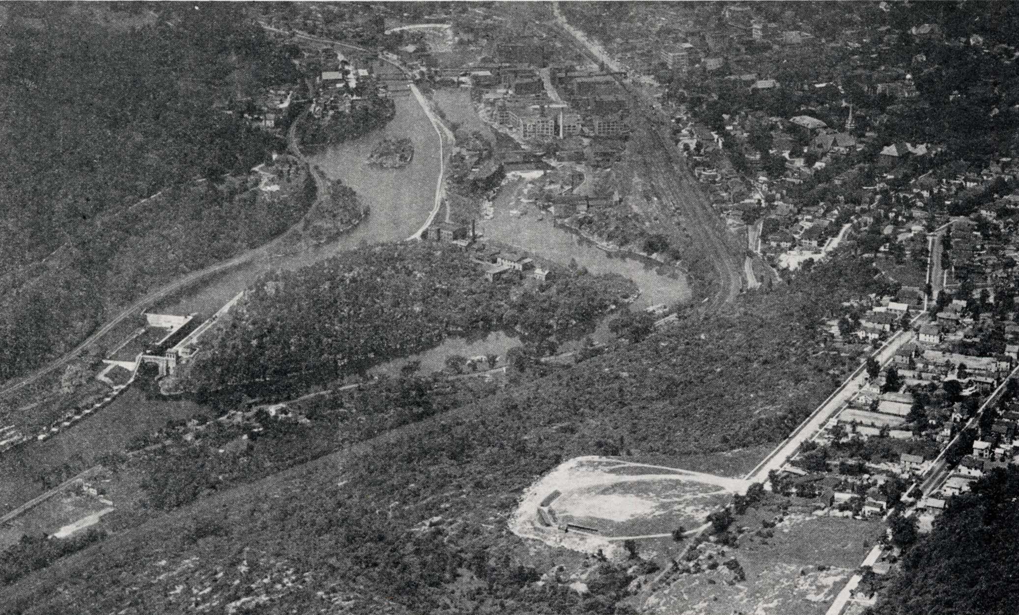
Photo: City of Little Falls

View from aeroplane showing Barge Canal Big Lock and Dam, Moss Island, South Shore road, West Shore tracks, New York Central Railroad and business center of city. Baseball Park and Dolgeville road in lower right-hand corner. The height of cliffs adjacent to the Mohawk River is not clearly shown here. The Burnt Rocks are 200 feet above the river and 100 feet above the railroad. In this picture the rocks look as though they were on a level with the New York Central tracks. Photo by Fairchild Aero Corp.

Go to top of page | back to: Chapter 125

You are here: Home » Resources » MVGW Home » Illustrations » City of Little Falls

http://www.schenectadyhistory.org/resources/mvgw/images/little_falls.html updated June 10, 2018

Copyright 2018 Schenectady Digital History Archive — a service of the Schenectady County Public Library

Statcounter