[View 9x enlarged version (496K)]
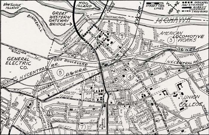
Map of the Center of Schenectady
Showing the position of the original stockade erected in 1661-2, which was burned in the French-Indian massacre of 1690. The Albany Turnpike (old Skanetade Trail) now State street, is shown running to the Schenectady terminus of the Great Western Gateway Bridge to Scotia, where the Old Mohawk Turnpike continues the New York to Buffalo Highway westward. The stockade of 1662 is indicated by dots.