[View 9x enlarged (243K) version]
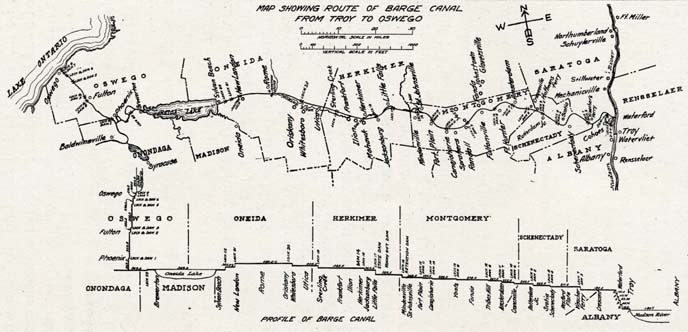
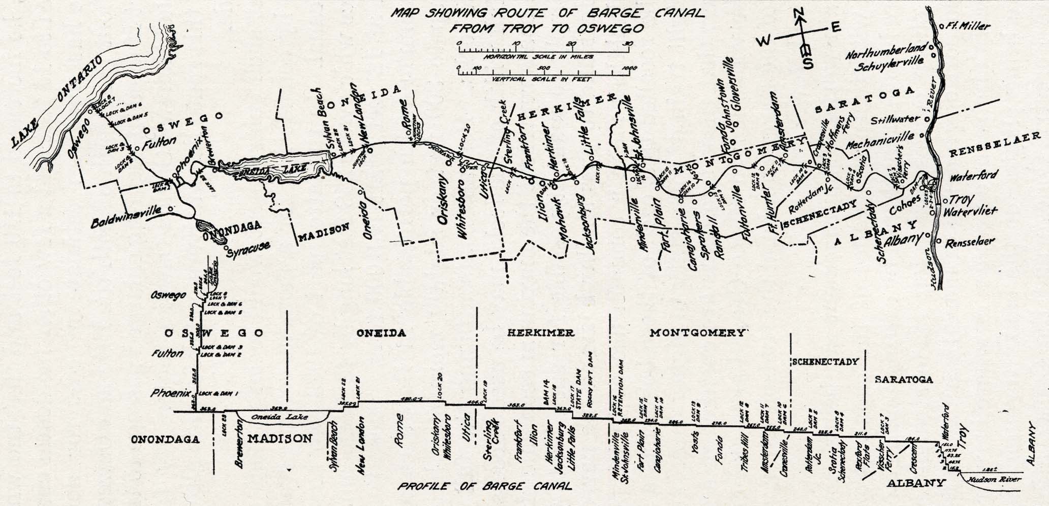
Map Showing Route of Barge Canal from Troy to Oswego
This map was furnished by the office of the State Engineer and Surveyor, through the courtesy of Capt. E. D. Hendricks, Eastern Division Engineer. It shows the course of the present Barge canal route from Troy to Oswego and Syracuse. It is the old Indian and Mohawk river Colonial waterway from Schenectady to Oswego, which figured largely in New York State colonial history.
Place names on map (roughly west to east) include Lake Ontario, Oswego, Fulton, Baldwinsville, Phoenix, Brewerton, Syracuse, Oneida Lake, Sylvan Beach, Oneida, New London, Rome, Oriskany, Whitesboro, Utica, Sterling Creek, Frankfort, Ilion, Mohawk, Herkimer, Jacksonburg, Little Falls, Mindenville, St. Johnsville, Fort Plain, Canajoharie, Sprakers, Randall, Fonda, Fultonville, Johnstown, Gloversville, Fort Hunter, Amsterdam, Cranesville, Rotterdam Junction, Hoffmans Ferry, Scotia, Schenectady, Visscher's Ferry, Cohoes, Waterford, Troy, Watervliet, Rensselaer, Mechanicville, Stillwater, Schuylerville, Northumberland, Fort Miller
The "Profile" section shows the following place names with depths: Oswego, Fulton, Phoenix, Brewerton, Sylvan Beach, Oneida, New London, Rome, Oriskany, Whitesboro, Utica, Sterling Creek, Frankfort, Ilion, Herkimer, Jacksonburg, Little Falls, State Dam, Rocky Rift Dam, Mindenville, St. Johnsville, Fort Plain, Canajoharie, Yosts, Fonda, Tribes Hill, Amsterdam, Cranesville, Rotterdam Junction, Scotia, Schenectady, Rexford Flats, Visscher Ferry, Crescent, Waterford, Troy, Albany