Map 10: from U.S.D.A., Aerial Photography, 1952
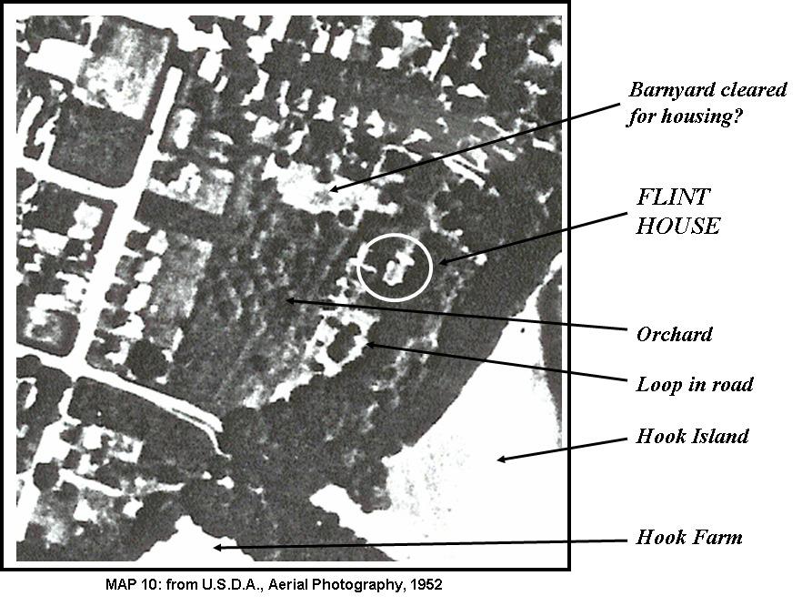
This 1952 aerial photo shows the area of the Flint House, Hook Farm and Hook Island. Other features indicated by arrows are "Barnyard cleared for housing?", "Loop in road" and "Orchard".
This page conforms to the XHTML standard and uses style sheets. If your browser doesn't support these, you may not see the page as designed, but all the text is still accessible to you.
SCHENECTADY DIGITAL HISTORY ARCHIVE
Bringing the heritage of Schenectady County, New York to the world since 1996
You are here: Home » Buildings » Village of Scotia » Flint House Archaeological Report » Map 10
[This information is from Flint House Archaeological Report, 2002 — 2003: Tales from the Glenville Woods by Stephen D. Jones, Ph.D., RPA, and others, and is reproduced here with his permission.]
This 1952 aerial photo shows the area of the Flint House, Hook Farm and Hook Island. Other features indicated by arrows are "Barnyard cleared for housing?", "Loop in road" and "Orchard".
You are here: Home » Buildings » Village of Scotia » Flint House Archaeological Report » Map 10
http://www.schenectadyhistory.org/buildings/scotia/flint_house/jones/map10.html updated March 30, 2015
Copyright 2015 Schenectady Digital History Archive — a service of the Schenectady County Public Library