This page conforms to the XHTML standard and uses style sheets. If your browser doesn't support these, you may not see the page as designed, but all the text is still accessible to you.
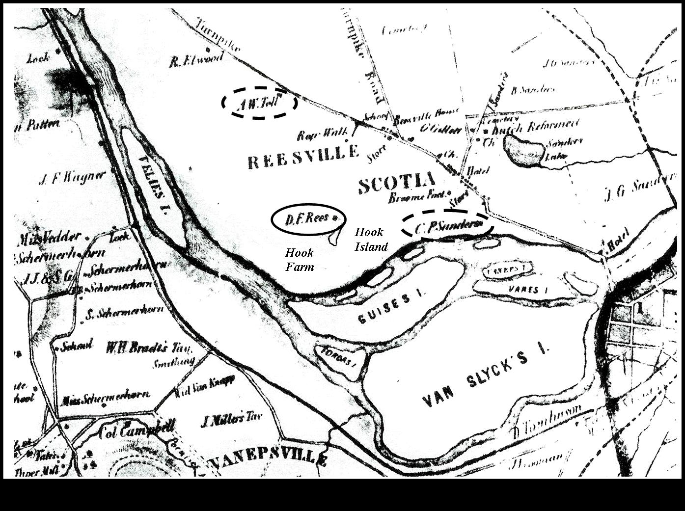
Map 6: 1856, Village of Scotia
[View 4x enlarged]
This 1856 map by Fagan of the Village of Scotia (including Reesville and Vanepsville) has numerous surnames indicating properties. Three have been circled: A. W. Toll, D. F. Rees and C. P. Saunders. Hook Farm and Hook Island have been marked.
http://www.schenectadyhistory.org/buildings/scotia/flint_house/jones/map06.html updated March 30, 2015
Copyright 2015 Schenectady Digital History Archive — a service of the Schenectady County Public Library